Hugo Neighborhood Association & Historical Society
|
Hugo Neighborhood Association & Historical Society |
|
|
SQUIER FAMILY: HUGO SETTLERS Brochure 74 in Hugo's Pioneers
Brochure Series
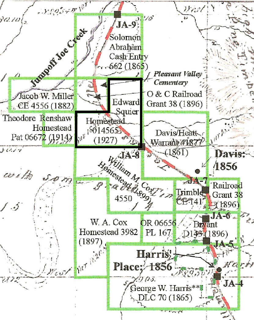
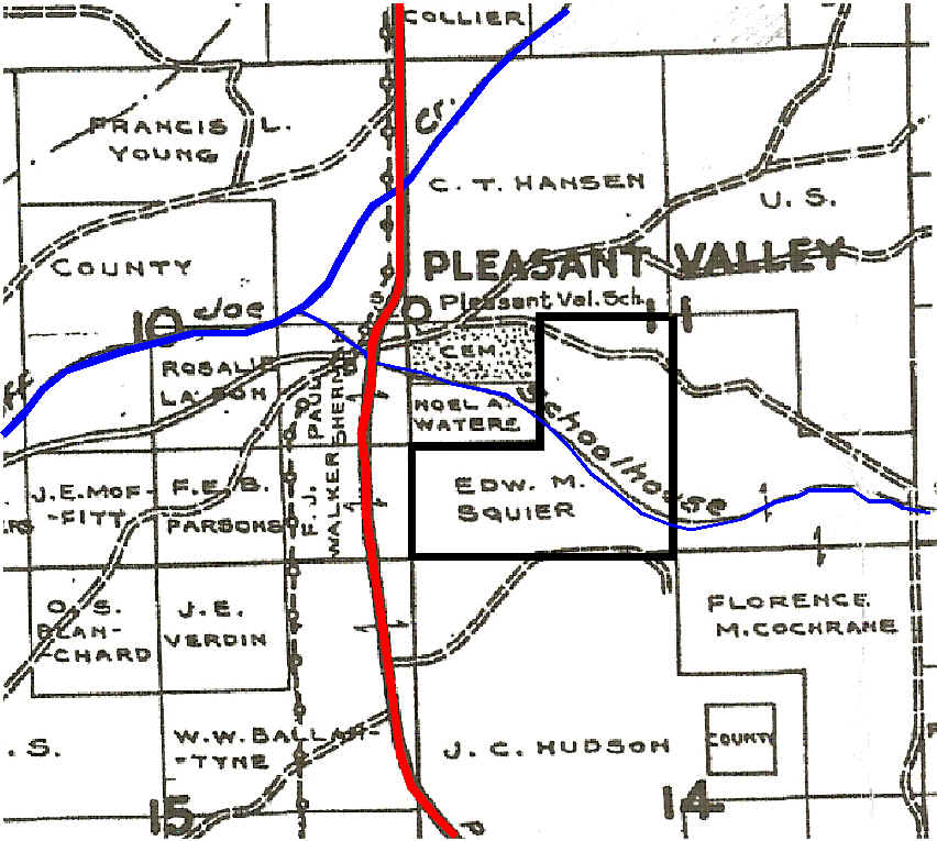
Quarry Section of Applegate Trail: 1856 Edward Squier Homestead: 1927 Applegate Trail The 1927 120 acre Squier homestead was located nearly astride the old Applegate Trail. It is clearly depicted on 2007 Josephine County Assessor maps for the old homestead.1-3
This same trail location is almost exactly the title used on the 1856 General Land Office (GLO) map. "Road from Willamette Valley to Jacksonville" The trail continues north from the homestead over Schoolhouse Creek to the west side of the Pleasant Valley Cemetery. 1856 GLO Field Notes: JA-84 The Applegate Trail was surveyed in 1856 on what would become the southern property line of the Squier homestead. Surveyed location JA-8 is on private property and has not been located in the field. 1916 the Chamberlain-Ferris Act provided for revest- ment to the federal government of title to lands remaining unsold and held by the Southern Pacific Railroad originally granted to the Oregon and California Railroad. These previous railroad lands came under the Homestead Act and there was another mini-land rush. The Edward Squier Family, Hugo Settlers: ca., 1920s - 1930s Applegate Trail The evolved Applegate Trail went through this homestead as late as 1895.5 However, this transportation route was abandoned soon after as the automobile came on line in Josephine County. It was official by 1921 with the paved Pacific Highway (Monument Drive) located to the west of the homestead and the lowlands of Schoolhouse Creek.
Edw. M. Squier's Homestead: 1932 1927 Squier Homestead On March 9, 1927 Edward Markham Squier was issued a 120 acre homestead patent in Hugo, Oregon (Patent No. 014565).1-2 This was a late homestead entry after the O & C lands came back to the United States from the Southern Pacific Railroad. Homesteader
1932 Edw. M. Squier was in possession of the Squier homestead.6 1942. U.S. WWII Army Enlistment Records, 1938-1946 Edward M. Squier was a white citizen born 1898 in Illinois. At the time of enlistment, July 13, 1942, he resided in Jefferson County, Colorado. During the war he was a private in the Army. He had two years of college. His civil occupation was baker or radio engineer, or electrical engineer. He was 71" tall and weighed 146 pounds. Want more information? Contact an officer of the Hugo Neighborhood on how you can become involved in your community’s history and land use.______________________________________________________________
|
|
© 2011 Hugo Neighborhood Association & Historical Society |