|
Home
Up
Hugo Tombstone Quarry Section of Applegate Trail
Thomas Bryant: Hugo Pioneer
Bryant Family: Federal Censuses
J.C. Cochrane Family: Early Hugo Pioneers
William A. Cox Family: Hugo Pioneers
W.M. Cox Family: Hugo Pioneers
John Davis: Warrant Locator
W.H. Flanagan Family: Hugo Pioneers
Harris: Hugo Pioneers
Lewis Heatt: Indian Fighter
Miller Family: Hugo Pioneers
Jacob Miller Family: Federal Censuses
Elizabeth F. Neely: Hugo Pioneer
Neely Family: Hugo Pioneers
Wm W. & E.J. Neely: Hugo Pioneers
Pleasant Valley School
PVC: Applegate Trail & Pleasant Valley Cemetery
PVC: Neely & Trimble Cemeteries
PVC: Pleasant Valley Cemetery: 1870s?
PVC: Tombstone Analysis
Renshaw Family: Hugo Settlers
Squier Family: Hugo Settlers
Samuel Trimble: Hugo Pioneer
| |
PLEASANT
VALLEY SCHOOL
Brochure 57A in Hugo's
Pioneers Brochure Series
Just North of the 1.5 mile Applegate Trail Nomination to Federal Register of Historic
Places
May 12, 2008
by
Hugo Neighborhood Association
Historical Society
Josephine County Historical Society
Rogue Advocates
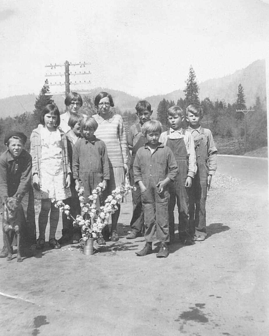
- Pleasant Valley School Students With
- Teacher Esther Ludwick: 1929 - 1930
Pleasant Valley Prairie
1865 Solomon Abraham Cash Entry
Solomon purchased 160 acres under Cash Entry No. 662 in Josephine County, Oregon. It was
issued August 15, 1865 to Solomon Et. Al. Abraham.1 - 3 This is the earliest
cash entry sale in Hugo, except for the year before by Samuel Trimble. The 1865 Abraham
Cash Entry would eventually become the site of the Pleasant Valley School close to the
Neely children’s graves.
1895 An "E. F." Neely identified on the 1895
Josephine County map was the owner of almost 600 acres where the Neely children and
Trimbles’ graves are located adjacent to the northern boundary of today’s
Pleasant Valley Cemetery (PVC).4
Pleasant Valley Prairie Most of Solomon’s
purchase was also prime agricultural land identified as a prairie in the 1856 General Land
Office Field survey notes.5 The prairie later became known as the Pleasant
Valley Prairie.
Pleasant Valley School: ca., 1890s - 1920s
1893 GLO Field Note: Applegate Trail
JA-9 & Prairie5
Pleasant Valley JA-9 54 Chains
- Chains
- 43.50 Enter Prairie & Bank bottom
- 54.00 Road to Jacksonville c NE & SW
- 60.00 leave Prairie & Enter trees NW&SE
- 65.25 to Jump off Jo branch 30 Lks wide C SW
1896 The PVC was adjacent to the school. The PVC
Association was formally formed by 11 men on May 30, 1896.6 The meeting took
place in the Pleasant Valley School. The 11 founders of the PVCA read like a
"Who’s Who" for the Hugo-Merlin area:
- . James Neely
. C. D. Sexton
- . William Crow
. James Wright
- . Joseph McCaslin
. James McCaslin
- . T. Rowe
. A. Cole
- . James Devaney
. George McCormick
- . Garrett Crockett
1923 Pleasant Valley is located at the south boundary
of Solomon’s cash entry.7 The Pleasant Valley School’s location was
near the Neely home next to the Neely children’s graves.7
Pleasant Valley School Not much is known about the
Pleasant Valley School. One teacher was Esther (Ludwick) Hansen.
Pleasant Valley Cemetery (PVC) & PVC Association
July 31, 1928 Sexton Mt. Fire Brought Under Control Grants Pass Daily Courier, July 31,
1928. A working hypothesis is that the school was burnt in this fire.
1932 Pleasant Valley is located next to the Pleasant Valley School's old location at the
south boundary of Solomon's cash entry.8
1955 Pleasant Valley is located at the south boundary of Solomon's cash entry.8
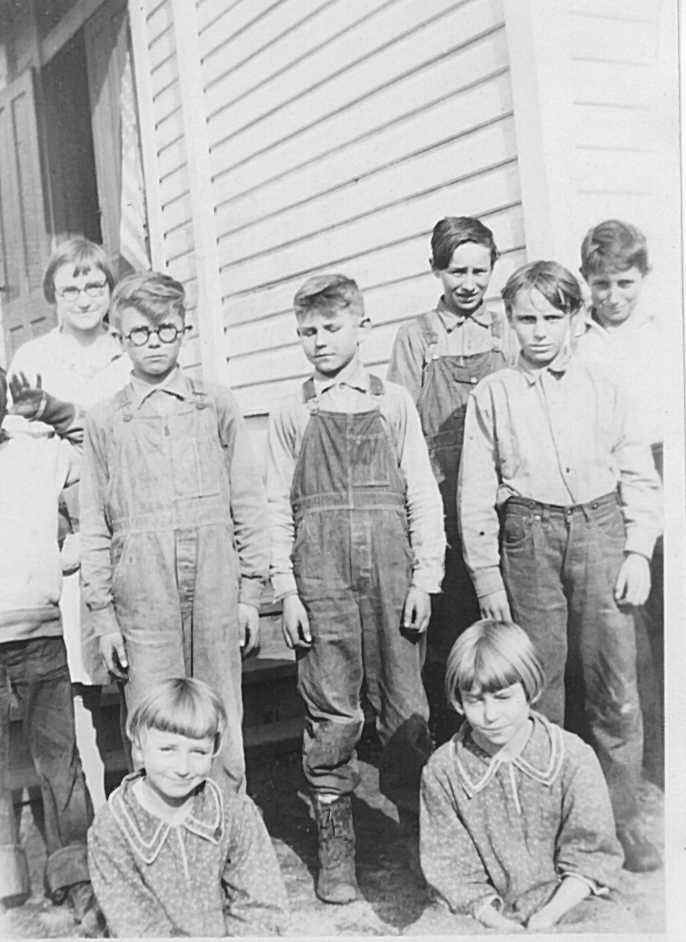
- Pleasant Valley School Students With
- Teacher Esther Ludwick: ca., 1920's
- Courtesy of Vern Ludwick
Want more information? Contact an officer of the Hugo
Neighborhood on how you can become involved in your community's history and land use.
______________________________________________________________
- 1. Bureau of Land Management (BLM), General Land Office
(GLO) Records. 2007. Official Federal Land Records Site (http://www.glorecords.blm.gov/).
Internet.
- 2. Hugo Neighborhood. 2007. Hugo Pioneers. Map Of
Federal Land Transfer in Hugo, Oregon. Hugo, OR.
- 3. Hugo Neighborhood. 2007. Abrahams: Hugo Pioneers. Map
Of Federal Land Transfer in Hugo, Oregon. Hugo, OR.
- 4. Koch, Joseph , Draughtsman. 1895 Official Josephine
County, Oregon. Map. Scale 1 inch = 1 mile. Meston - Dygert Book M’F’G.
Portland, OR.
- 5. General Surveyor Office of Oregon. Subdivision Lines For
1856 Map (T.34., R. 6. W., Willamette Meridian). Field Notes. Surveyor Luke G Hyde.
Contract February 19, 1855; Surveyed March 31, 1856.
- 6. Sexton, Charles, Clerk, PVCA. May 30, 1896. Minutes of
Meeting At Which PVCA was formed. Hugo, OR.
- 7. USGS Quadrangle. Edition of 1904, reprinted 1923.
Surveyed 1901 - 1902. Scale 1: 125,000.
- 8. Metsher, Chas. F. 1932 Metsker Map. Josephine County,
Oregon. Portland, OR; Metsher, Chas. F. 1955 Metsker Map. Josephine County, Oregon.
Portland, OR.
Back to Top
|
