Hugo Neighborhood Association & Historical Society
|
Hugo Neighborhood Association & Historical Society |
|
|
LEWIS HEATT: INDIAN FIGHTER Brochure 31 in Hugo's Pioneers
Brochure Series
Quarry Section of Applegate Trail: 1895
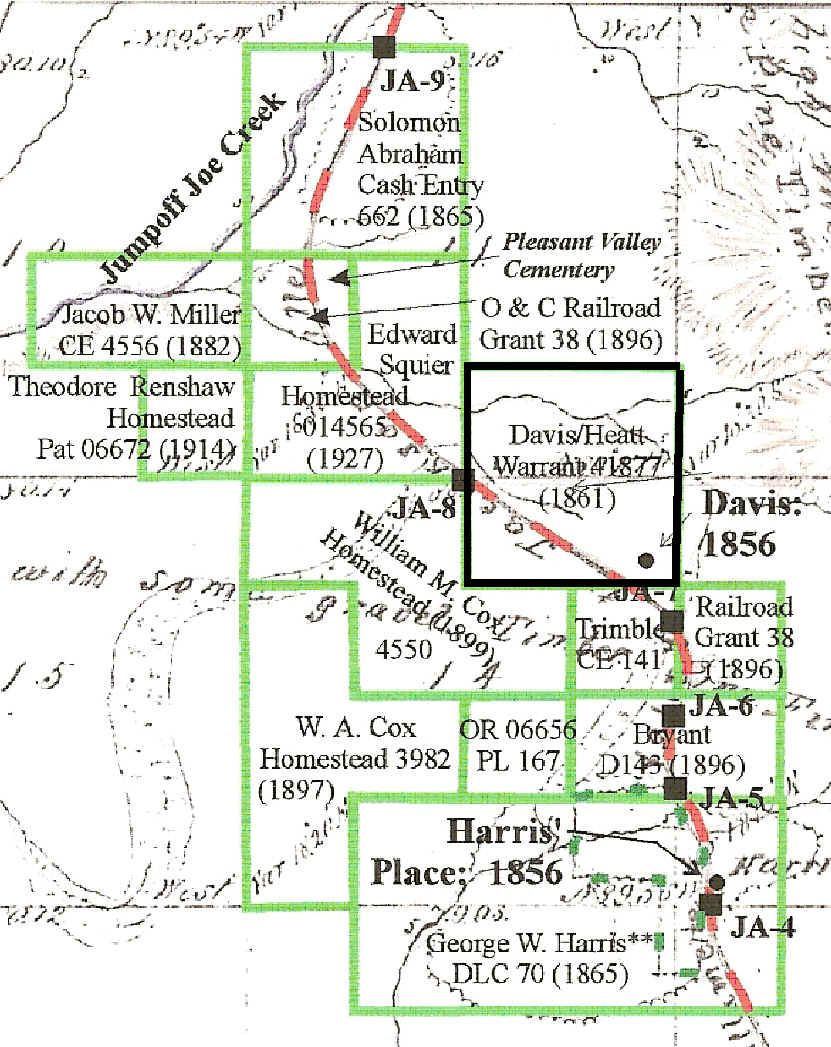
Private Lewis Heatt, Rogue River Indian War: 1855 - 1866 November 11, 1861 Military Warrant President Abraham Lincoln issued the Hugo patent for military service.1 - 5 "WHEREAS, In pursuance of the Act of Congress, approved March 8,1855 entitled an "Act in addition to certain Acts grants Bounty Land to certain Officers and Soldiers who have been engaged in the military service of the United States,"there have been deposited in the GENERAL LAND OFFICE, Warrant No. 41877 for 160 acres in favor of Lewis Heatt, Private, Captain Miller Company Militia, Rogue River War with evidence that the same has been duly located upon, the south half of the south east quarter of Section eleven and the north half of the north east quarter of Section fourteen, . . ." Lewis Heatt’s Military Warrant: 1861 Natural Prairie & Pasture6-7 The military patent included most of the open wetlands of what would later become part of the 240-acre J. C. Cochrane ranch. The warrant and the ranch’s location had a reason: natural sub-irrigation for pasture during the winter, spring, and early summer. The 1856 GLO survey and map records a house on what would become the 160 acre Davis/Heatt military warrant, but no family name identified on 1856 GLO map.1-2 Part of the warrant is in the present day I-5 right-of-way. The house would have been just to the east of the present freeway in the Josephine County Sportsman Association Park (JCSA Park) . J. L. Hall Tombstone: Died 1867
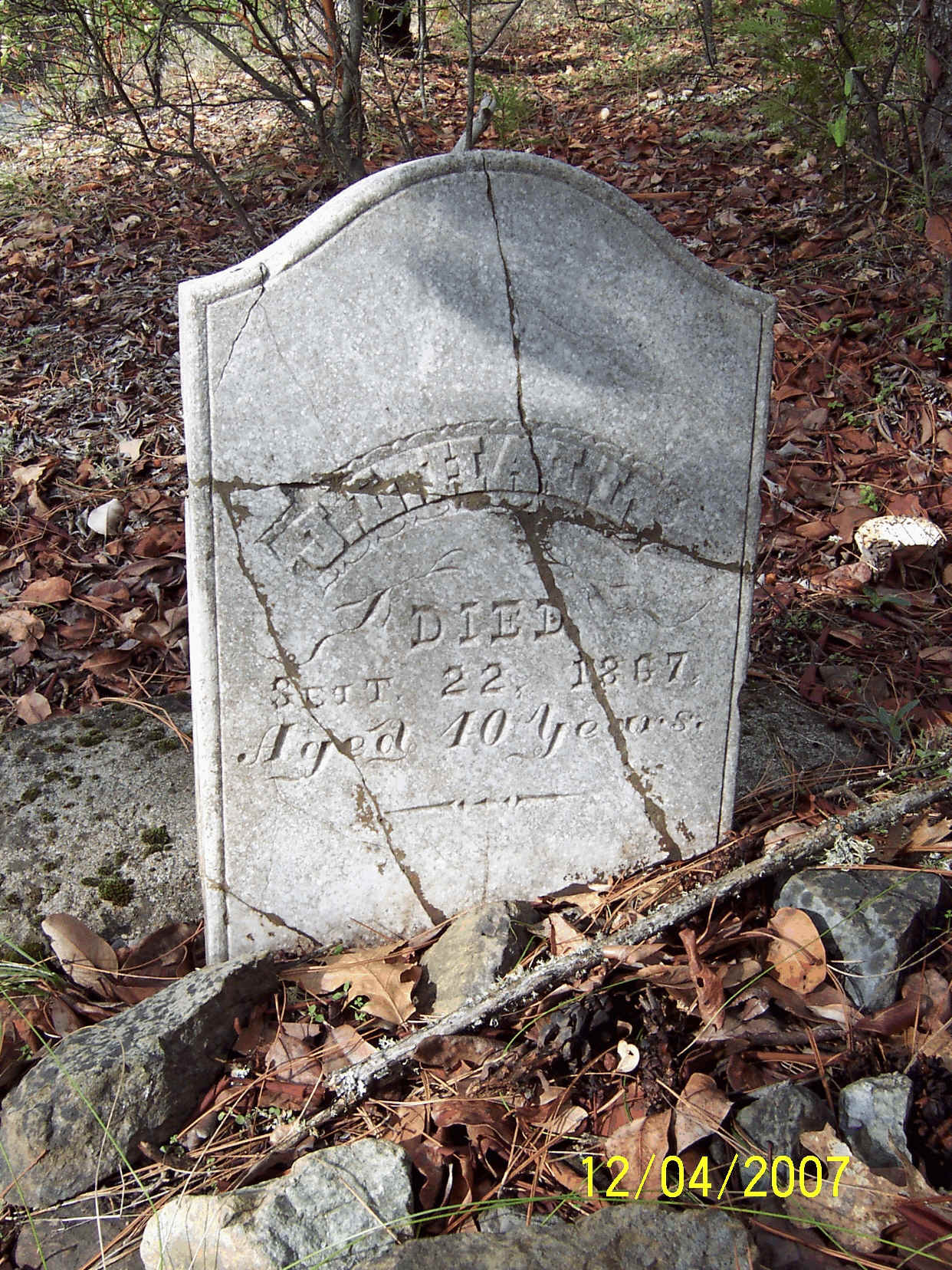
"J. L. Hall, Died Sept 22 1867, Aged 40 years" Local anecdotal information is that this grave was previously located in or near the I-5 right-of-way and moved to its present location during ca., 1958 - 1960 when I-5 was being built through the area. A speculative hypothesis is the J. L. Hall is the same Lewis Heatt identified in the military warrant.
Hall Tombstone: 2007 Hall’s Draw Hall’s tombstone at the entrance to the park and the southern entrance to a draw in the general location of JA-5 and JA-6 is the rationale for the naming of the draw as Hall’s Draw. Want more information? Contact an officer of the Hugo Neighborhood on how you can become involved in your community’s history and land use.______________________________________________________________
|
|
© 2011 Hugo Neighborhood Association & Historical Society |