Hugo Neighborhood Association & Historical Society
|
Hugo Neighborhood Association & Historical Society |
|
|
W.M. COX FAMILY: HUGO PIONEERS Brochure 15 in Hugo's Pioneers
Brochure Series
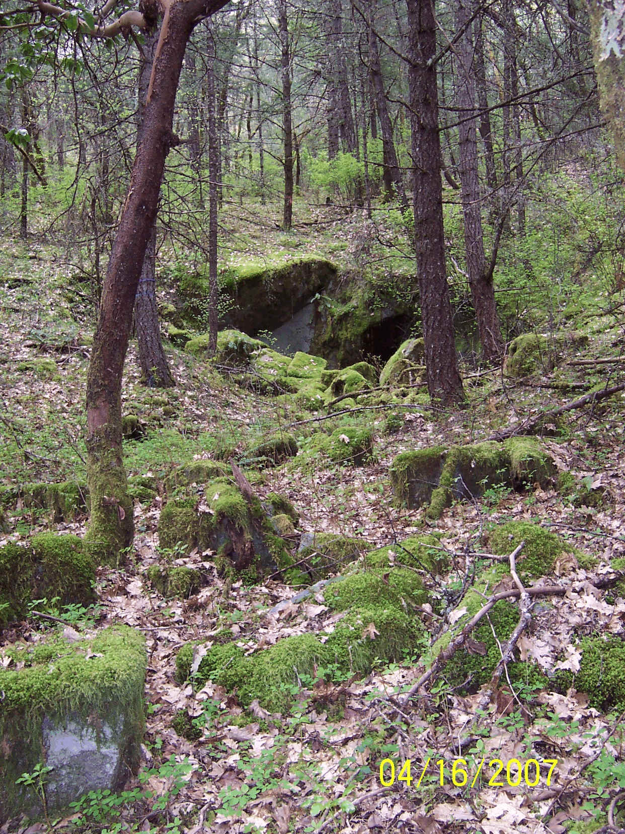
Tombstone Quarry William M. Cox Homestead & Quarry Site Along Applegate Trail 1856 William M. Cox was born in California in 1856. 1899 Hugo Homestead On May 31, 1899 William M. Cox ("Junior") were issued a homestead patent for 160 acres in Hugo, Oregon (Patent No. 4550).1-2 Hugo Granite Tombstone Quarry Site (Quarry Site)4-5 The Quarry Site is located on the old W. M. Cox homestead. The historical and present land owners for the 40 acre tract the Quarry Site is located on has a relatively simple history of four owners. The parcel is described as SW 1/4 of the NE 1/4 of Section 14, T.35 S., R.6W., WM.
There may have been a mining claim for the quarry site prior to the homestead certificate being issued to Cox in 1899. This research needs to continue. It is unknown whether W. M. Cox was a quarry operator. The 1910 deed to G. G. Weatherwax and B. F. Seaton identified they were doing business under the style and firm name of Weatherwax and Seaton and that the property included a "discovery shaft of stone quarry". W. M. Cox Family, Hugo Pioneers: ca.,1890 - 1900s Cox Family 3-4 The Cox family resided on, and proved up, the property for some time prior to the homestead certificate being issued in 1899. 1856 William M. Cox was born in California in 1856. By 1880 he was with his wife, Lola, in Pendleton, Umatilla County, Oregon working as a laborer. 1899 The W. M. Cox homestead certificate was issued subject to certain reservations, including: ". . . and also subject to the right of the proprietor of a vein or dike to extract and remove his ore, therefore, should the same to found to penetrate or intersect the premises hereby granted, . . .". 1900 W. M. Cox was with his wife Love and four children in the Merlin Precinct, Josephine County, Oregon. He was a teamster. 1903 W. M. Cox purchased 40-acres under the cash entry program in 1903. This purchase was some distance from his homestead near the north entrance of Tunnel No. 9. 1910 W. M with wife Lola, three children, in Phoenix Precinct, Jackson County, Oregon. He was a fruit farmer. 1920 W. M with wife Lola, son Earl, in Washington District, Norfolk County, Virginia; poultry farmer. 1930 W. M. with new wife Sereata, son Earl, in Washington District, Norfolk County, Virginia. He was a poultry farmer. 1944 W. M. died Stuarts Draft, Staunton County, Virginia. Hugo Granite Tombstone Quarry Site Quarry Site 4-5 The site is small, around 1.5 acres. It is a rare site which was operational from ca.., 1880s through 1929. It has a high probability of qualifying for listing on the National Register of Historic Places.
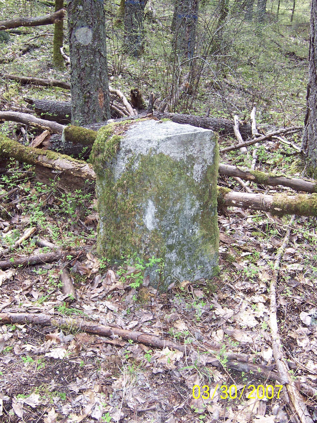
Discovery Stone at Quarry Site Want more information? Contact an officer of the Hugo Neighborhood on how you can become involved in your community’s history and land use.
|
|
© 2011 Hugo Neighborhood Association & Historical Society |