Hugo Neighborhood Association & Historical Society
|
Hugo Neighborhood Association & Historical Society |
|
|
WILLIAM A. COX FAMILY: HUGO PIONEERS Brochure 14 in Hugo's Pioneers
Brochure Series
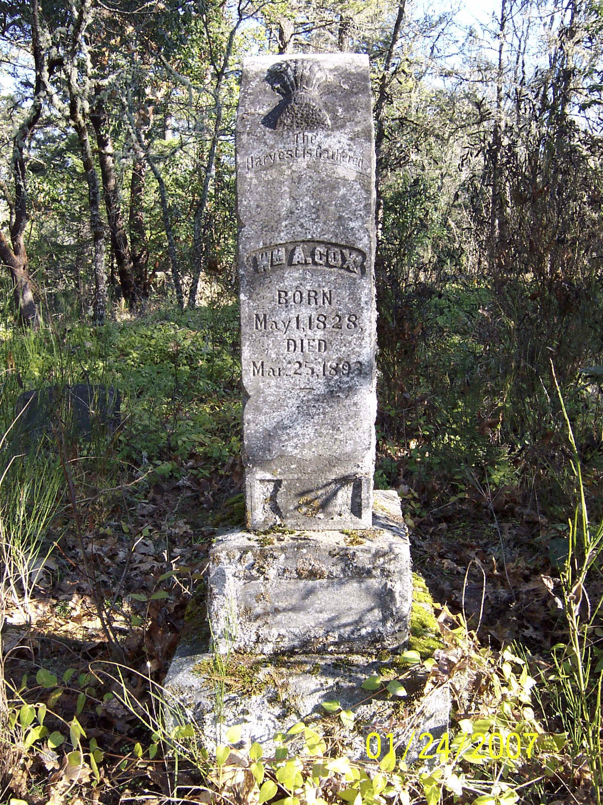
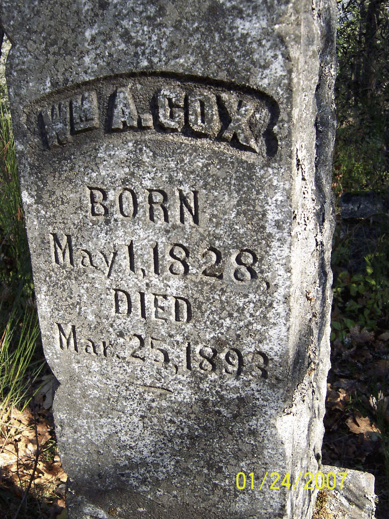
W. A. Cox Tombstone
William A. Cox ("Senior") Homestead Hudson Bay Trappers Trail and/or Applegate Trail? William A. Cox’s son, William M. Cox, was born in California in 1856. 1897 W. A. Cox Hugo Homestead On October 20, 1897 William A. and Elizabeth Cox were issued a homestead patent for 160 acres in Hugo, Oregon (Patent No. 3982).1-2 William A. Cox is the father of William M. Cox. Elizabeth was also issued the patent because W. A. died before the final certificate was issued. W. A. is buried in the PVC. Mother Elizabeth Cox is also buried at the PVC, but has no marker. She lived until 1932, when her son, W. M., had long since removed from Oregon. The 160 acre W. A. Cox homestead was adjacent to his son’s 160 acre homestead. Cox Family 3-4 The W. A. Cox family resided on, and proved up, the property for some time prior to the homestead certificate being issued. Hugo Granite Tombstone Quarry Site (Quarry Site)3-4 The Quarry Site is located on the old William. M. Cox homestead. The parcel is described as SW 1/4 of the NE 1/4 of Section 14, T.35 S., R.6W., WM. W. A. Cox Family, Hugo Pioneers: ca.,1890 - 1903 Pleasant Valley Cemetery (PVC) Over three dozen tombstones in the PVC were evaluated as having an extremely high probability of coming from the Quarry Site as identical-looking stones, including rubble, drill marked, squared and flat finished tombstones, which can be found at the Quarry Site and the PVC.5
W. A. Cox Tombstone William A. Cox Tombstone W. A. was born May 1, 1828. He died May 25, 1893. His 55.5" tall obelisk tombstone is in the PVC and is a good example of a three-stoned tombstone having both flat finishes and squared stone finishes. It also demonstrates how the Quarry Site stone is losing the flat finished carvings on the back side of the vertical tombstone. The size, complexity, and workmanship of the William A. Cox tombstone feels like a monument to the father and an advertisement of the quarry tombstone business.
Hugo Granite Tombstone Quarry Site Quarry Site 4-5 The site is small, around 1.5 acres. It is a rare site which was operational from ca.., 1880s through 1929. It has a high probability of qualifying for listing on the National Register of Historic Places. 1899 Homesteads In 1862, Congress established the Homestead Act which provided for a gift of 160 acres to actual settlers who would settle on and cultivate the lands and reside upon them for five years. It became effective on January 1, 1863, the same day President Lincoln issued his Emancipation Proclamation. The W. M. Cox homestead certificate was issued subject to certain reservations, including: ". . . and also subject to the right of the proprietor of a vein or dike to extract and remove his ore, therefore, should the same to found to penetrate or intersect the premises hereby granted, . . .". Want more information? Contact an officer of the Hugo Neighborhood on how you can become involved in your community’s history and land use.
|
|
© 2011 Hugo Neighborhood Association & Historical Society |