Hugo Neighborhood Association & Historical Society
|
Hugo Neighborhood Association & Historical Society |
|
|
PVC: APPLEGATE TRAIL & PLEASANT VALLEY CEMETERY Brochure 59 in Hugo's Pioneers Brochure Series Part of the 1.5 mile Applegate Trail Nomination to Federal Register of Historic Places
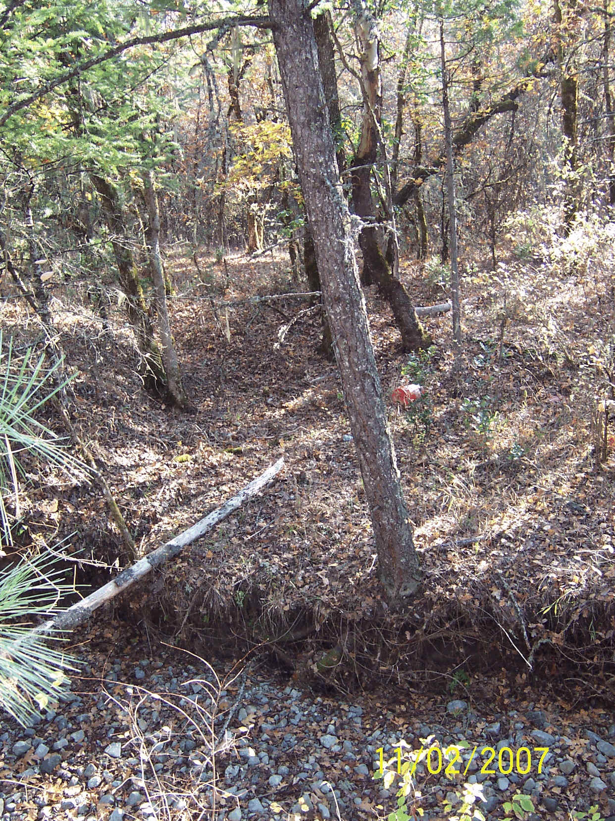
Applegate Trail: 1846 - 20081846 - On August 9, 1846, a large group of wagons set out west from Fort Hall to travel the new Applegate Trail. By mid-October 1846 the emigrants were traveling up the rugged mountainous terrain on the Trappers' Trail toward the unnamed Mt. Sexton Pass. The California National Historic Trail and its Applegate Trail branch are administered by the National Park Service. The State of Oregon recognizes the value and significance of the Applegate Trail: ORS 358.057(3) 1856 - In 1856 the Applegate Trail was documented by the General Land Office (GLO) survey and map as located on land that would become the PVC. During the 1850s through the 1870s the Hugo region saw the first set of immigrants that were not passing through the area on their way to someplace else. They were coming to stay either to farm lands under the donation land claim and homestead laws and/or to seek gold in the new southern Oregon discoveries. Untimely deaths required the placement of loved ones in cemeteries out of the area, or the use of family lands. For example, Hiram Niday and his daughter Mary were buried on the Niday's DLC No. 40 in 1855, and the Neely children on their home place from 1877 to 1882. 1895 Applegate Trail - The official 1895 map of Josephine County locates the Applegate Trail at the western boundary of the PVC. 1 Pioneer Pleasant Valley Cemetery Association (PVCA): 1890s 2007 Applegate Trail Location - The Hugo Emigrant Trails Committee's field research corroborates the 1895 map that the location of the trail was not through the PVC, but adjacent to it at its western boundary. The Committee feels it has located the Applegate Trail's wagon ford location over what would become Schoolhouse Creek, and a later bridge location long gone from the memories of local residents.
Ford Over Schoolhouse Creek: 2007 O & C - Congress granted lands to the O & C Railroad to help finance construction of a railroad from Portland, Oregon to the California border.
Construction started in 1869, and by 1872 the railroad was completed to Roseburg. After a long hiatus, due to shaky finances and high expenses, construction resumed in 1881. The first official train arrived in Grants Pass December 2, 1883, the same year that the Tunnel No. 9, was completed. 2 Oregon & California (O & C) Railroad Deed to PVCA: 1899
PVC Association - The PVC is a private pioneer cemetery adjacent to the Applegate National Historic Trail in northern Josephine County managed by the PVC Association (PVCA). The PVCA was informally operating on the railroad land as early as May 30, 1892. It was formally formed by 11 men on May 30, 1896. The Articles of Incorporation for the PVCA were filed with the State of Oregon on June 14, 1897. Two years later the PVCA received a deed from the O & C Railroad. 3 Today the PVCA is a non-profit corporation registered with the Oregon Secretary of State, Corporation Division. Its mission is to manage the PVC as an active cemetery, including the preservation and protection of its historic values. Its business name is the Pleasant Valley Cemetery Association (Non-Profit Corporation Registry Date & number: April 5, 1971 - 092679-15). 3 Want more information? An ongoing research issue is whether the PVC's origins were as early as ca., 1872 - 1883. Contact an officer of the Hugo Neighborhood on how you can become involved in your community's history and land use. ______________________________________________________________
|
|
© 2011 Hugo Neighborhood Association & Historical Society |