Hugo Neighborhood Association & Historical Society
|
Hugo Neighborhood Association & Historical Society |
|
|
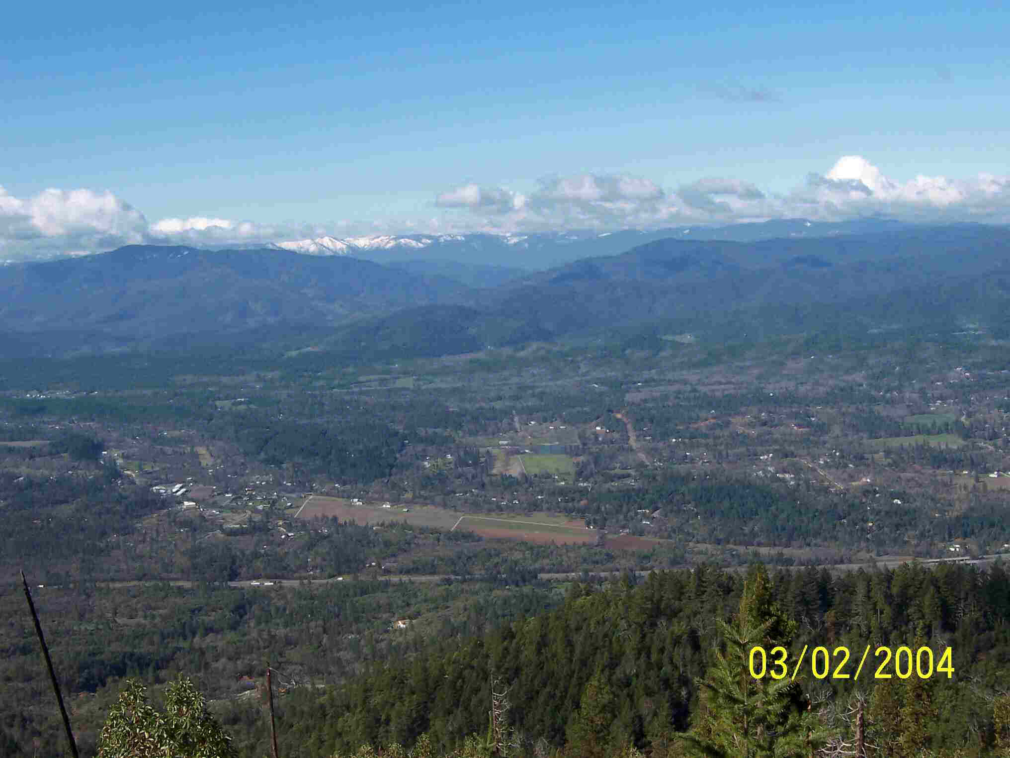
WALKER MOUNTAIN Walker Mt. Viewpoint Elevation 3,200'
The Jumpoff Joe Creek Valley from I-5 to the Winona Road junction is a beautiful drive in itself. The valley has a farming and ranching history along with the wonder of gold mining, especially the historic Lucky Queen Mine. An early 1910s lumber town, Mountain, was located in its headwaters, which was the beginning of an unusual 11.5-mile long lumber flume all the way to the Town of Three Pines on the Southern Pacific Railroad right-of-way. Walker Mountain is a dominate feature in the Hugo neighborhood. It is 3,858' high and named after two Hugo pioneer brothers, Augustus and Wesley Walker. The brothers were 1850s donation land claimants (Augustus Walker - Donation Land Claim Patent No. 861; Wesley Walker - Donation Land Claim Patent No. 778). Walker Mountain Elevation 3,858 Vehicle Travel Miles
More Information Five popular Hugo view points are:
The 32-minute drive from the Hugo I-5 interchange to the Walker Access Road junction with Winona Road (35-5-9) is on public pavement and paved roads. The Walker Access Road Number 35-5-9 to the north viewpoint is a rough bedrock gravel road , some feel road is pushing 2-wheel and needs 4-wheel drive. (see map) Want more information? Contact an officer of the Hugo Neighborhood on how you can become involved in your community’s history projects. OUTDOOR RISK WARNING STATEMENT - WARNING! There is a personal risk the individual assumes anytime he ventures into the "wilds" of Hugo. Non-paved roads can be dangerous anytime, but especially in near vertical terrain (i.e., narrow, steep, curvy, blind corners, edge of cliff, poor road material, overhanging vegetation, mud holes, loose rocks, changing conditions, etc.). Besides dangerous roads there are other environmental elements to prepared for: weather, hazardous terrain, potentially dangerous plants, and critters. The big "real" common concerns are hot summer heat, ticks, poison oak, and rattlesnakes. The Hugo Neighborhood assumes no liability for information provided, nor any harm that may result from individuals traveling into the "wilds." See Link to expanded risk warning statement for more information. |
|
@ 2010 Hugo Neighborhood Association & Historical Society |