Hugo Neighborhood Association & Historical Society
|
Hugo Neighborhood Association & Historical Society |
|
|
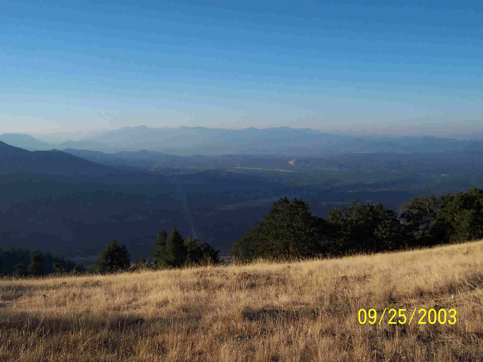
BURGESS GULCH Burgess Gulch Viewpoint Elevation 3,000'
There are lots of safe and comfortable scenic view points to discover picturesque Hugo from the air. Well, from the viewpoints looking down, it feels like being in the air, sorta. The Burgess Gulch Viewpoint is about 12 vehicle miles and 34 minutes from the Hugo I-5 interchange (see map). Consider stopping at the Applegate Trail Museum on the way. It is well worth it. Mt. Sexton Elevation 3,834' Mt. Sexton is a dominate feature in the Hugo neighborhood. It is 3,834' high and named after Hugo pioneers, David and Caroline (Stumbo) (Niday) Sexton. David was an Indian fighter in the 1850s and Caroline was an 1850s donation land claimant (Donation Land Claim No. 40; Patent No. 1479). Vehicle Travel Miles
More Information Five popular Hugo view points are:
The 40-minute drive from the Hugo I-5 interchange to the Burgess Gulch Viewpoint is public pavement and gravel roads (two-wheel drive). Want more information? Contact an officer of the Hugo Neighborhood on how you can become involved in your community’s history projects. OUTDOOR RISK WARNING STATEMENT - WARNING! There is a personal risk the individual assumes anytime he ventures into the "wilds" of Hugo. Non-paved roads can be dangerous anytime, but especially in near vertical terrain (i.e., narrow, steep, curvy, blind corners, edge of cliff, poor road material, overhanging vegetation, mud holes, loose rocks, changing conditions, etc.). Besides dangerous roads there are other environmental elements to prepared for: weather, hazardous terrain, potentially dangerous plants, and critters. The big "real" common concerns are hot summer heat, ticks, poison oak, and rattlesnakes. The Hugo Neighborhood assumes no liability for information provided, nor any harm that may result from individuals traveling into the "wilds." See Link to expanded risk warning statement for more information. |
|
@ 2010 Hugo Neighborhood Association & Historical Society |